Ha Giang Loop Highlights: What to See in the Road Trip 2026
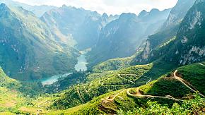
Located in the northern part of Vietnam, Ha Giang has a typical karst landscape with stretching mountains covered with forest. The river, the canyon, the villages and the terraced fields are all part of the scenery, with a road that winds around the hillside not only connects the village but also leads curious visitors to the deep, misty mountain.
Here is the highlight information about this round trip in Ha Giang; hopefully, it will give you some inspiration for your next unexpected journey.

Quan Ba Heaven Gate
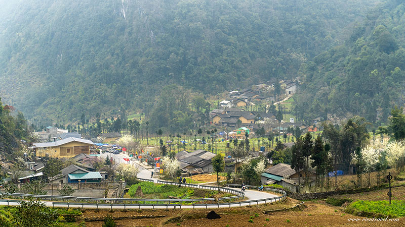
While riding along the 4C to the Tam Son, you will pass through the Quan Ba Valley, also known as the Quan Ba Heaven Gate, due to its altitude of nearly 2000m. Especially if you arrive early in the morning when the mist and fog still cover the summit, leaving only the hazy shadow of the mountain, it gives everyone there a wonderful atmosphere of wandering in the sky.
It is very thoughtful to have a cafe where you can order a drink, sit on the viewing kiosk and look out over the scenery around you. Behind you are the twisting roads you have already traveled, and in front of you are the limestone mountains wrapped in lush green, stretching into the distance and waiting to be explored.
 Ha Giang Beauty
Fairy Hills
As the limestone mountains ahead give way to the pretty cone-shaped peaks, you'll know you're approaching your next stop, the village of Tam Son.
The Fairy Hills are two almost symmetrical twin peaks, different from the mountain you have seen on the way you came here, which are quite delicate and elegant, like a pair of pointy hats of the little fairy. It could be the pretty scenery of the cute green hills or the blessing of the little fairy; locals have cleared the land and built villages there.
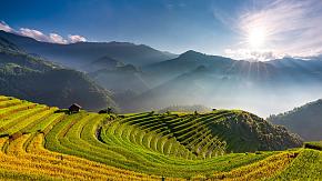
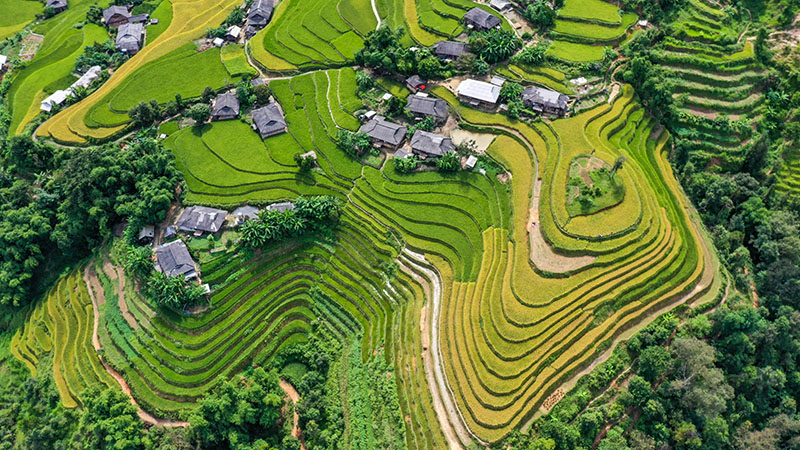
Suppose your loop journey is right into autumn; you will find another view of the pretty peaks gradually surrounded by the golden rice fields and the tiny villages with occasional clouds of smoke.
Lung Khuy Cave
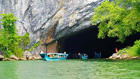
Once you have seen the green peaks of the karst landscape on the surface, it is worth making a little detour on your way to the village of Yen Minh to visit the Lung Khuy Cave. It is a wonderful cave formed by the action of the earth's crust and water, which can show you another characteristic of the karst landmarks.
Climbing the stone steps to the hillside entrance gives you a magnificent view of the caves you will encounter. Massive stalactite columns connect the top and bottom of the cave, telling the long story of its ancient history.
The stalagmites, which have only recently emerged from the flowing water, are only a few fingers in size and give a different view to the other slightly longer columns. Marvel at nature's ingenuity and let your imagination run wild with its fanciful shapes.
H'mong King Palace
This ancient two-story building is almost 100 years old. Thanks to the protection of the walls and their partial fortification, it is still possible to see the whole of this magnificent palace.
Firstly, there is the high stone wall surrounding the main building, which protects the treasures still stored inside. Through the gate, you can enter the carefully tended gardens, now featuring giant trees.
Follow the beautifully carved stone slabs to the palace gates, and you'll notice the Chinese style evident in the white walls and black bricks. The symmetrical carvings on the wooden doors of the ground floor are still vivid, while the first floor boasts a French-style fence and is decorated with paintings of lions, dragons, phoenixes, and bats, reflecting Vietnamese characteristics.
No wonder a precious treasure is hidden deep in the mountain.
Lung Cu Flag Tower
A monumental tower could symbolize the destination of this round trip, which is located in the northernmost village of Vietnam, Lung Cu, next to China. It sits on the top of the hill, so you can see the waving red flag from afar as you ride past the paddy field around the tranquil village house.
There is a path leading up to the tower as well as to the top, which could be one of the best spots for your memorial photos. So feel free to follow the stairs and up to the intricate decoration of the tower and, more importantly, the great view of the northern field.
Dotted on the ground are the golden harvest land and houses of the lively locals and the silver pass which you have just traveled, leading in another direction for your return journey.
 Rice Terrace, Ha Giang
Ma Pi Leng Pass
For the most part, the journey on the Ha Giang Loop is a pleasant ride with lovely nature scenery and the occasional local house passing by. Even if you're traveling alone, you can always find some traces of human life to accompany you. But when you cross the Ma Pi Leng Pass between the villages of Dong Van and Meo Vac, you will feel the true sense of traveling through great nature.
Considered one of the most impressive parts of the trip, the natural beauty of the Ma Pi Leng Pass is almost overwhelming. On one side are the vast limestone rocks covered with plants and moss.
On the other are thousands of high cliffs plunging into the river of Nho Que, with a striking color of emeralds. As you take a break at the corner and look out over the far mountains above and the tranquil river below, you may wonder whether it is the water falling from the green hill that colors the river or it is the emerald river that dyes the surrounding mountains a brilliant green.
Tu San Canyon
It is the gap between the mountains of Meo Vac and Dong Van, also known as the deepest canyon in Southeast Asia. As you gently descend the winding path to the foot of the mountain Meo Vac, you will find villages that you haven't seen in a long time.
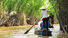
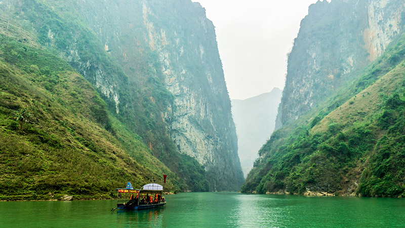
With terraces around them and the Tu San Alley below, where you can rest your hips and take a boat ride on the Nho Que River. It would be a fantastic boat experience on your Ha Giang Loop trip.
With the fresh air and the gentle breeze to take away your fatigue, catch the ethnic children playing by the river, or the fisherman sitting on his raft. You can sit in the back to capture the ripples behind your boat, or in the front to watch the giant coming close to you. Although it has an altitude of almost 900 meters, it still hides its body and face in the mist and fog.
 Nho Que River in Ha Giang
Scenery Along the Way
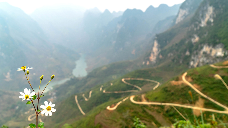
This is an exciting mountain loop trip with tiny winding roads connecting the northern villages settled in the verdant foothills, revealing an unspoiled area of paradise for nature lovers.
You can travel from Sapa or Ha Noi to Ha Giang City, the starting point of the loop, then head northeast through the villages of Tam Son and Yen Minh before reaching Lung Cu, the northernmost town in Vietnam. For the return journey, follow another road through Dong Van and Meo Vac, then descend to the Du Gia and finally back to Ha Giang.
This route takes about 3-5 days round trip and covers a distance of about 400km. You can hire a local driver and guide to take you on an in-depth tour of the valley, or of course, rent a motorbike and drive yourself, stopping off at your favorite spots or staying a few days in a local villager's guesthouse to take in the sights at a leisurely pace.
 Ha Giang Loop
How about this fantastic trip to the mountains with unexpected surprises? Whether it is to admire the grandeur of nature or to marvel at how life adapts to it, this Ha Giang Loop trip can offer you much more than that. If you want to explore this amazing land and start an exciting adventure, you may check some useful tips for your preparation. Or you can feel free to contact Odynovo and make your own travel plans directly.
Related Posts You May Like
What Our Clients Say
Explore the latest verified reviews of Odynovo's travel services on Tripadvisor, Google, Trustpilot, Product Review and more trusted platforms.

